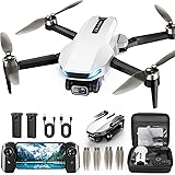
The accompanying video provides a visual showcase of the IG Drones Delta 400, a sophisticated fixed-wing drone engineered for extensive aerial operations. While the footage elegantly highlights the drone’s form and potential operational scenarios, a deeper understanding of its capabilities and the profound impact of large-scale mapping drones in various sectors is often sought. This article aims to provide comprehensive insights into the world of fixed-wing drone mapping, focusing on how a system like the IG Drones Delta 400 is transforming survey, mapping, and inspection tasks across India and beyond.
The Evolution of Geospatial Data Collection and Fixed-Wing Drones
Historically, the acquisition of precise geospatial data over vast areas has been a resource-intensive endeavor. Traditional methods frequently involved manned aircraft surveys or laborious ground-based techniques, which were characterized by significant time commitments, high operational costs, and potential safety risks. The emergence of Unmanned Aerial Vehicles (UAVs), commonly known as drones, has democratized access to aerial data, profoundly changing how information about our physical world is gathered.
First, the distinction between rotary-wing and fixed-wing drones is critical when considering large-scale applications. Rotary-wing drones, like quadcopters, are renowned for their agility and ability to hover, making them ideal for detailed inspections of confined areas or complex structures. However, their endurance and speed are typically limited, restricting their efficiency when vast territories need to be covered, which is often a requirement in major infrastructure projects or agricultural surveys. This is where fixed-wing drones demonstrate their distinct advantages.
Secondly, fixed-wing drones are designed to glide, much like traditional airplanes, allowing them to achieve significantly longer flight times and cover much greater distances on a single charge. This inherent efficiency makes them the preferred choice for mapping extensive landscapes, linear infrastructure, and expansive agricultural fields. Their operational cost per square kilometer is substantially lower, and the speed at which data can be acquired is unparalleled by other drone types or conventional methods, thereby enhancing project timelines and overall productivity.
Introducing the IG Drones Delta 400: A Fixed-Wing Powerhouse for Large Scale Mapping
The IG Drones Delta 400 has been positioned as a leading large scale mapping fixed wing drone, specifically tailored to meet the demanding requirements of various industries within India. This particular UAV is meticulously designed to optimize efficiency and accuracy, which are paramount in modern geospatial applications. Its robust construction ensures reliable performance even under challenging environmental conditions, which are frequently encountered across India’s diverse geographical terrains.
One key aspect of its design philosophy revolves around extended flight endurance, a feature that significantly reduces the number of launch and recovery cycles required for large projects. This directly translates into operational savings and an accelerated data acquisition process. The integration of advanced navigation systems and high-resolution imaging capabilities ensures that the data collected is consistently of superior quality, providing a solid foundation for detailed analysis and informed decision-making across numerous sectors.
Furthermore, the Delta 400 is not merely a data collection tool; it represents a comprehensive solution for professionals seeking unparalleled performance in survey mapping and inspection. Its capabilities are particularly appealing to those involved in large-scale infrastructure development, environmental monitoring, and urban planning. The emphasis on user-friendly operation, despite its advanced technical features, is a testament to its design focus on practicality and widespread applicability, enabling a broader range of users to leverage its powerful functionality.
Key Capabilities and Specifications for Precision Survey Mapping and Inspection
The robust engineering of the IG Drones Delta 400 fixed wing drone is evidenced by its core capabilities, which are precisely what make it suitable for India’s most ambitious projects. Its extended flight time is often highlighted, enabling a substantial area to be mapped in a single mission. This translates into unparalleled efficiency for large-scale operations where vast stretches of land or infrastructure require detailed scrutiny.
Another crucial aspect involves its sophisticated payload integration system, which permits the use of various high-resolution sensors. These can include advanced RGB cameras for detailed photogrammetry, multispectral cameras for agricultural analysis, or even thermal sensors for specific inspection tasks like identifying heat anomalies in pipelines. The flexibility in sensor choice allows the Delta 400 to be adapted to a wide array of specialized applications, ensuring that precise data is collected for specific project requirements.
Beyond these, a critical factor for accurate mapping is the drone’s precise navigation and flight control systems. The Delta 400 is equipped with advanced GPS and inertial measurement units (IMUs) that ensure stable flight paths and highly accurate geotagging of captured images. This precision is fundamental for generating accurate orthomosaics, digital elevation models (DEMs), and detailed 3D models, which are indispensable tools for engineers, planners, and surveyors who rely on integrity of their geospatial data.
Diverse Applications of the IG Drones Delta 400 in Survey, Mapping, and Inspection
The versatility of the IG Drones Delta 400 fixed wing drone means it can be deployed across a multitude of industries, providing significant value in each. Its capacity for large scale mapping fixed wing drone operations makes it an invaluable asset where comprehensive aerial data is required quickly and efficiently. Several key sectors benefit immensely from its advanced capabilities for survey mapping inspection.
One significant advantage is observed in **Infrastructure Monitoring**. Extensive linear projects such as highways, railways, power lines, and pipelines can be efficiently surveyed and inspected for anomalies, wear, or damage. Periodic inspections using the Delta 400 allow for proactive maintenance planning, thereby mitigating potential failures and ensuring operational continuity. This approach significantly reduces the risks associated with manual inspections and provides a detailed, auditable record of asset conditions over time.
Another crucial application lies within **Precision Agriculture**. Farmers and agricultural scientists can utilize the Delta 400 to monitor crop health, assess irrigation efficiency, and identify areas affected by pests or diseases across vast farmlands. Multispectral sensors, when integrated, can provide Normalized Difference Vegetation Index (NDVI) data, which is vital for optimizing fertilizer application, managing water resources, and ultimately increasing crop yields. This data-driven approach transforms traditional farming into a more scientific and sustainable practice.
Furthermore, in **Mining and Quarry Management**, the IG Drones Delta 400 proves indispensable. Regular aerial surveys can be conducted to calculate stockpile volumes, monitor excavation progress, and assess site safety. The generation of precise 3D models allows for accurate volumetric analysis and helps in optimizing operational layouts, leading to more efficient resource extraction and improved safety protocols. This data is critical for compliance reporting and strategic planning within the mining sector.
Lastly, its contribution to **Urban Planning and Development** cannot be overstated. High-resolution orthomosaic maps and 3D city models created by the Delta 400 provide essential data for urban planners, architects, and governmental agencies. This information is utilized for smart city initiatives, property assessments, land use mapping, and planning future infrastructure projects. The ability to quickly update these maps allows for dynamic urban management, responding effectively to the rapid changes characteristic of modern cities.
Advantages Over Traditional and Rotary-Wing Solutions for Large-Scale Operations
When considering large-scale survey mapping and inspection tasks, the IG Drones Delta 400 fixed wing drone presents several distinct advantages that set it apart from both traditional methods and its rotary-wing counterparts. The operational efficiency achieved with a fixed-wing design is paramount for projects covering significant geographical areas. This efficiency is realized through its ability to cover more ground at higher speeds, requiring fewer flights to complete a given task.
Firstly, the cost-effectiveness for large projects is significantly enhanced. The longer flight endurance and faster coverage rate of fixed-wing drones like the Delta 400 mean that fewer flight hours are needed, which translates directly into lower operational costs related to battery cycling, operator time, and equipment wear. While the initial investment might be higher than some smaller rotary drones, the return on investment for large-scale applications is often much quicker due to these efficiencies.
Secondly, the quality and consistency of data collected by the IG Drones Delta 400 are often superior for broad area mapping. Fixed-wing drones typically maintain a more consistent altitude and speed during their mission, which contributes to more uniform image acquisition and better overlap between images. This consistency is vital for photogrammetric processing, ensuring that highly accurate orthomosaics and 3D models are generated without significant distortions or gaps that can arise from less stable flight patterns.
Lastly, safety is inherently improved when fixed-wing drones are employed for large area survey mapping inspection tasks. The reduced need for ground personnel to access hazardous or inaccessible terrain for data collection minimizes human exposure to risks. Furthermore, advanced autopilot systems and pre-programmed flight paths ensure that missions are executed with precision, reducing the likelihood of operational errors or incidents. The IG Drones Delta 400, therefore, offers a safer, more reliable, and more economical solution for demanding large-scale geospatial data requirements.
The Operational Workflow: From Data Acquisition to Actionable Insights
The successful deployment of a large scale mapping fixed wing drone like the IG Drones Delta 400 involves a structured operational workflow, ensuring that raw data is transformed into valuable, actionable insights. This process begins long before the drone takes flight and extends well beyond its landing, involving several critical stages that are meticulously managed to guarantee accuracy and utility of the final output.
First, thorough mission planning is meticulously undertaken. This stage involves defining the specific area of interest, determining the required ground sampling distance (GSD) for the desired output resolution, and configuring flight parameters such as altitude, speed, and image overlap. Sophisticated flight planning software is utilized to create an optimized flight path, which is then uploaded to the IG Drones Delta 400, ensuring autonomous and efficient data capture over the designated territory.
Secondly, the data capture process is executed with precision. Once the Delta 400 is launched, it autonomously follows the pre-programmed flight path, systematically capturing high-resolution images or other sensor data. The drone’s advanced navigation and stabilization systems ensure that each image is geotagged accurately and taken from a consistent perspective, which is crucial for subsequent processing. This automated collection significantly reduces human error and enhances the consistency of the collected dataset.
Finally, post-processing is initiated once all data has been acquired. The collected imagery is meticulously processed using specialized photogrammetry software. This software meticulously stitches together thousands of individual images to generate highly accurate orthomosaic maps, detailed digital elevation models (DEMs), and realistic 3D models of the surveyed area. These derived products provide an invaluable resource for analysis, measurement, and visualization, empowering professionals to make informed decisions for various survey mapping inspection applications across India.
Surveying Your Queries: An IG Drones Delta 400 Q&A
What is the IG Drones Delta 400?
The IG Drones Delta 400 is a sophisticated fixed-wing drone specifically designed for extensive aerial operations like large-scale survey, precise mapping, and detailed inspection applications.
What is a fixed-wing drone?
Fixed-wing drones are designed to glide like traditional airplanes, allowing them to achieve significantly longer flight times and cover much greater distances on a single charge compared to rotary-wing drones.
What kind of tasks is the IG Drones Delta 400 used for?
It is used for professional tasks such as large-scale mapping, surveying vast areas, and detailed inspections in sectors like infrastructure monitoring, agriculture, mining, and urban planning.
Why is the IG Drones Delta 400 good for large mapping projects?
Its fixed-wing design allows for extended flight endurance and faster coverage of vast areas, making data collection more efficient and cost-effective for large projects compared to other drone types or traditional methods.